Parks and Green Spaces in Newcastle City Centre
Newcastle keeps a thousand acres of grazed common land, the oldest public park on Tyneside and a riverside path all within walking distance of Grey's Monument. Here is how the city centre's green space fits together.
Very few British cities can claim open common land within sight of their main shopping street, and fewer still have cattle grazing ten minutes from a department store. Newcastle does both. The city centre sits with a thousand acres of moor pressing down on it from the north, a Victorian park wrapped around the back of the football ground, a river path along its southern edge and a wooded valley running up its eastern side. You can be in genuine green space from anywhere in the centre inside a quarter of an hour on foot, and this guide covers what is actually there.
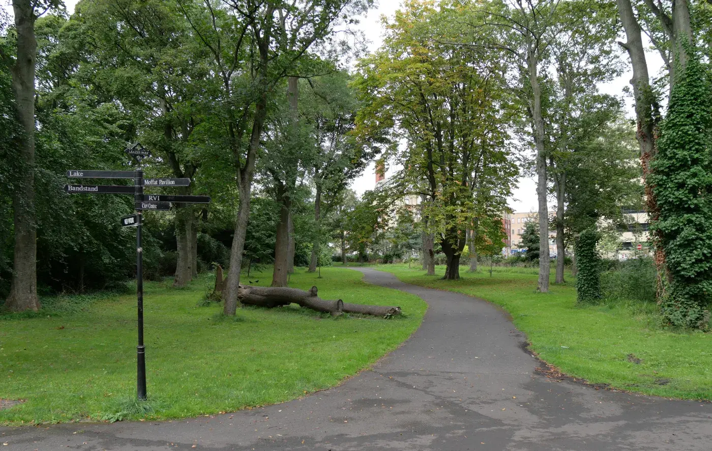
Leazes Park
Leazes Park is the oldest public park on Tyneside, opened on 23 December 1873 after a petition signed by around 3,000 working men asked the council for somewhere to walk in open air. The layout was drawn up by the town surveyor John Fulton around a long lake that follows the course of the buried Lort Burn, and the park carries a Grade II heritage designation on the national register of historic parks and gardens.
The Victorian bones are still legible. A stone terrace was added in 1879, the Jubilee Gates went up in 1896 to mark Queen Victoria's Diamond Jubilee, and a bust of Alderman Hamond, one of the aldermen who pushed the park through, followed in 1908. A second lake dug in 1893 was filled in by 1949 to make bowling greens and tennis courts, which is why that end of the park reads as flat and formal while the lake end feels wooded. By the 1980s the whole thing had badly declined; a £3.7 million Heritage Lottery Fund award in 2001 paid for a restoration completed in 2004, and it has held up well since. There is a lake circuit, playground space, tennis and basketball courts, a sensory garden and picnic areas.
What makes it unusual is the setting. The park runs right up against St James' Park on one side and the Royal Victoria Infirmary on another, so you get the strange experience of walking beside a lake with a 52,000-seat stadium rising over the trees.
Best for: The closest proper park to the retail centre, and the easiest one to reach on foot from Monument or St James Metro.
The Town Moor
The Town Moor is the defining green space of Newcastle and the reason the city centre stops where it does. It covers roughly 1,000 acres, more than double the size of London's Hyde Park and larger than New York's Central Park, and it begins at the top of the city centre and runs north.
It is common land, not a park, and the distinction matters. Freemen of Newcastle hold the right to graze cattle on the moor, a right that appears to predate the Norman Conquest and was formalised by royal charter in the early thirteenth century. The herd is capped at 800 head, and cattle are out on the grass through the summer, so walkers share the ground with them and dogs need to be under control. There are no flowerbeds, no gates and very little shelter. What there is instead is sky, which is not something the city centre otherwise offers.
Two fixtures bring most people here. The Town Moor parkrun runs every Saturday at 9am over 5km, with a 2km junior parkrun on Sunday mornings, both free. And in late June the moor is taken over by The Hoppings, a travelling fair long billed as among the largest in Europe, which runs for nine days and finishes on the last Sunday of the month. The start area for the Great North Run also sits alongside the moor each September.
Best for: Long walks, running, dog walking and the only genuinely big horizon near the centre.
Castle Leazes, Nuns Moor and the rest of the common
The Town Moor is not one field but a set of linked commons, and knowing the names helps you read a map. Castle Leazes lies on the southern side, between Leazes Park and Spital Tongues. Nuns Moor sits to the north-west beyond the main road, with Hunters Moor to the west, and Dukes Moor and Little Moor on the north-eastern side towards Gosforth. All of it is open and walkable, and the whole complex is what gets counted in that thousand-acre figure.
The practical use of this is that you can string the sections together into a much longer walk than any single park allows, and come out at a different edge of the city from the one you went in by. Castle Leazes in particular gives you a route from the back of Leazes Park towards Spital Tongues without touching a road.
Exhibition Park
Exhibition Park occupies the south-eastern corner of the Town Moor and is the city centre's busiest formal park. It started life as Bull Park, set aside for recreation under the Town Moor Improvement Act of 1870, and took its present name from the Royal Mining Engineering Jubilee Exhibition of 1887, which drew around two million visitors.
Its bigger moment came in 1929, when the North East Coast Exhibition ran here from May to October and recorded 4,373,138 admissions, closing with a firework display on 26 October. One building survives from it: the art deco Palace of Arts, Grade II listed, which housed a science museum and later a military vehicle museum before Wylam Brewery moved in during 2016. Its Grand Hall is worth a look in its own right. The park's other listed structure is a cast iron bandstand of 1875, which predates both exhibitions and was originally the focal point of Bull Park.
A £3 million Heritage Lottery refurbishment completed in July 2015 reworked the lake and the wider park infrastructure. There are tennis courts, a basketball court, croquet lawns, a playground, a skatepark and a café, and a miniature railway operated by the Tyneside Society of Model and Experimental Engineers runs on the site. The Newcastle Mela takes over the park on the August bank holiday weekend.
Best for: The best bet with children, and the one city-centre park with a skatepark and a boating lake.
Claremont Road and the Barras Bridge approach
The stretch between Haymarket and Exhibition Park is worth treating as green space in itself rather than just a way of getting somewhere. From Barras Bridge, with its war memorials and planted ground, Claremont Road climbs along the southern edge of the moor with university buildings on one side and open grass on the other. It is the shortest possible transition from city centre to common land.
It also links two things people often visit separately. The Great North Museum: Hancock sits at Barras Bridge at the bottom of the climb, and Exhibition Park is at the top, so a museum visit and a walk on the moor make a straightforward single outing on foot.
Best for: Use this as the route between Haymarket Metro and the moor rather than cutting through traffic.
Old Eldon Square
Old Eldon Square is the only real patch of green inside the retail core. Built between 1825 and 1831 as part of the redevelopment of the town centre by John Dobson and Richard Grainger, it lost the Georgian terraces along two of its sides to the Eldon Square shopping centre in the 1970s, which is why it now feels half enclosed and half exposed.
At its centre is the Newcastle and District war memorial, designed by Charles Leonard Hartwell and unveiled by Earl Haig in 1923, a bronze group of St George and the dragon known as War and Peace. The square is where the city holds its Remembrance Day commemoration. On any ordinary day it functions as the place people sit down when they need five minutes away from Northumberland Street, and given how little green there is in that part of town it earns its keep.
Best for: Somewhere to sit mid-shop, and the city's Remembrance Day focal point.
The Quayside riverside walk
The Quayside path is the city centre's best flat walk and, on a clear evening, its best view. It runs along the north bank of the Tyne beneath a run of bridges that includes the High Level Bridge, the Swing Bridge, the Tyne Bridge and the Gateshead Millennium Bridge, and forms part of National Cycle Route 72, Hadrian's Cycleway, so expect to share it with bikes.
Head west and the path takes you under the bridges towards The Close and the older merchant buildings below the castle. Head east and it runs out past the law courts towards the mouth of the Ouseburn, roughly a quarter of an hour on foot from the Tyne Bridge, where you can turn inland up the valley. Crossing the Millennium Bridge and walking back along the Gateshead side makes an easy circuit. A market takes over the Quayside on Sundays.
There is no shade and no grass to speak of, so treat it as a walk rather than a park. For a break with a view, The Bridge Hotel has a terrace at Castle Garth overlooking a surviving stretch of the medieval town wall, and at the far eastern end Free Trade Inn sits on the bank above the river looking straight back down at the Tyne Bridge.
Best for: Best done as a loop over the Millennium Bridge and back across the High Level.
The Ouseburn valley
The Ouseburn is the city centre's green corridor to the east, a steep wooded valley carrying a burn down to the Tyne. The lower part is the old industrial quarter, now full of studios, music venues and bars, but there is real green space threaded through it and the valley path is one of the most interesting walks in Newcastle precisely because the industry and the trees are tangled together.
Ouseburn Farm, a free-entry city farm founded by local residents in 1976 and run as a charity, occupies around ten acres on the site of the former Northumberland Lead Works and is the obvious stop with young children. From there the path continues north under the Byker viaducts. Along the way the valley takes in Seven Stories on Lime Street and The Cluny in the old Dobson-designed flax mill, so a walk up the burn can easily absorb an afternoon.
Best for: Walk it northwards from the Quayside rather than driving in; the valley only makes sense on foot.
Summerhill Square
West of the centre, past Westgate Road, Summerhill Square is a late Georgian residential square built around an informal open space and garden plots, and the centrepiece of the Summerhill Conservation Area. The area holds around eighty Grade II listed buildings plus the Grade II* Church of St Matthew on Summerhill Street, and the open space at its heart is on the council's local list.
It is not a destination park and it has no facilities. What it offers is a quiet, leafy, almost entirely residential square within a few minutes of Central Station, which is a rare enough thing on that side of the city to be worth knowing about.
Just beyond the centre
Two green spaces sit close enough to walk to but properly belong to the neighbourhoods north and east of the centre. Jesmond Dene is the upper continuation of the Ouseburn valley, laid out by Lord Armstrong and his wife in the 1860s and given to the people of Newcastle in 1883, opening the following year. It has woodland, crags, a waterfall, the ruins of St Mary's Chapel, the shell of the Old Mill and a free Pets Corner that has drawn families since the 1960s. The former road bridge at its southern end, Armstrong Bridge, is now closed to traffic and carries pedestrians only.
Adjoining it on the eastern side are Armstrong Park and Heaton Park, which together with the Dene make a continuous run of parkland. All three sit in Jesmond and Heaton rather than the city centre, but from the mouth of the Ouseburn you can walk to them without leaving green space, which is the whole point of the valley.
Know of another green space in or around the city centre we should include? Get in touch via our contact page.
Local businesses mentioned
St James' Park
St James' Park, Strawberry Place, Newcastle upon Tyne, NE1 4ST
Wylam Brewery
Palace of Arts, Exhibition Park, Newcastle upon Tyne, NE2 4PZ
Great North Museum: Hancock
Barras Bridge, Newcastle upon Tyne, NE2 4PT
The Bridge Hotel
Castle Garth, Newcastle upon Tyne, NE1 1RQ
Free Trade Inn
St Lawrence Road, Byker, Newcastle upon Tyne, NE6 1AP
Seven Stories, The National Centre for Children's Books
30 Lime Street, Ouseburn, Newcastle upon Tyne, NE1 2PQ
The Cluny
36 Lime Street, Ouseburn, Newcastle upon Tyne, NE1 2PQ
Never miss what’s on
Join the weekly Newcastlecity.live digest — the best events, news and local tips, straight to your inbox. Free, one email a week.
What's On
John Pope Quintet + Urvashi
7:30 PM · The Cumberland Arms, James Place Street, Ouseburn, Newcastle upon Tyne, NE6 1LD
Mathew Jonson (Live) and Cousin Dan
11:00 PM · Cobalt Studios, 10-16 Boyd Street, Ouseburn, NE2 1AP
Comic Con at Utilita Arena
9:00 AM - 6:00 PM · Utilita Arena, Arena Way, Newcastle, NE4 7NA